Share Contractor Selection on Facebook
Share Contractor Selection on Linkedin
Email Contractor Selection link
The project is on track. We anticipate selecting a contractor and obtaining project approvals in January.
Share Plan Q & A on Facebook
Share Plan Q & A on Linkedin
Email Plan Q & A link
We heard a few questions and ideas for the plan.
Q: Could the path be widened? Could a 'step-off' area be added? Could the erosion along the path be repaired?
A: We are planning for some very minor erosion repairs to restore the embankment to it's original 1960s design which was a 6 foot wide path with a 2:1 slope on either side. Repair areas and areas that show concentrated flow paths will be reinforced with erosion control blankets until the plants are established. Adding fill to accommodate a 'step-off' area would require additional study and engineering and is out of scope for this landscape restoration project. Further, the wetland and floodplain impacts would present a design and permitting challenge.
Q: Could the plants have variable heights, with some taller species?
A: The plant palette includes a variety of heights, textures, colors, and bloom times to provide interest and beauty all season long. Some species reach a max height of 6 inches while a majority reach 1 to 3 feet, and a few can get as high as 5 feet. The native plant palette PDF in the Documents section provides more details on height, bloom color, and bloom time. It will take a few years for the plants to reach their full beauty and mature heights - we're open to feedback and can make adjustments on plant composition after this initial establishment period.
Q: Could snags be incorporated for wildlife habitat?
A: We are not planning to install any live cuttings or tree stumps into the bank. The existing clay embankment on which the path is built was installed in the 1960s and is in good condition. Drilling live cuttings or tree stumps into clay embankment would take further study and engineering and was out of scope for this landscape restoration project. In areas where snags are naturally occurring, we are planning to leave them in place. We'll have a better sense for these after initial green ash tree removal and buckthorn brushing is complete.
Share Reminder - Provide your input by September 30th on Facebook
Share Reminder - Provide your input by September 30th on Linkedin
Email Reminder - Provide your input by September 30th link
Submit your questions, comments, ideas and stories by September 30th.
Share Provide your input by September 30th on Facebook
Share Provide your input by September 30th on Linkedin
Email Provide your input by September 30th link
Please submit your input on the concept plan by September 30th. In October we'll summarize what we heard and describe how input was considered.
How to submit input and ask questions
- Share your reactions and ideas on the Ideas Tab
- Ask a question on the Q & A Tab
- Call or email a staff person
Share Concept Plan Available Now on Facebook
Share Concept Plan Available Now on Linkedin
Email Concept Plan Available Now link
Check out the plan overview, rendering, and native plant palette in the Documents section. We'll have full-size posters available for viewing at the September 14th Open House.
How to submit input and ask questions
- Join us at the Open House on September 14th at 6:15PM at the Edina Public Works Building, 7450 Metro Blvd
- Share your reactions and ideas on the Ideas Tab
- Ask a question on the Q & A Tab
- Call or email a staff person
Share Save the Date - Open House set for September 14th on Facebook
Share Save the Date - Open House set for September 14th on Linkedin
Email Save the Date - Open House set for September 14th link
The Wooddale Path Design Review Open House will be held at 6:15PM at the Edina Public Works Building, 7450 Metro Blvd.
The open house immediately precedes the annual Lake Nancy Lake Association meeting in the same location, starting at 6:45PM. Staff will remain for a Q&A session at the beginning of the Lake Association meeting. All are welcome to attend the open house and opening Q&A session, it is not exclusive to Lake Association members.
The concept design will be posted to this project page in advance of the meeting. Copies of the concept design will also be available at the open house.
Share Sun Current Feature on Facebook
Share Sun Current Feature on Linkedin
Email Sun Current Feature link
The Wooddale path project was featured in the Sun Current today. Check it out here.
Share Historic aerial photos show major landscape changes on Facebook
Share Historic aerial photos show major landscape changes on Linkedin
Email Historic aerial photos show major landscape changes link
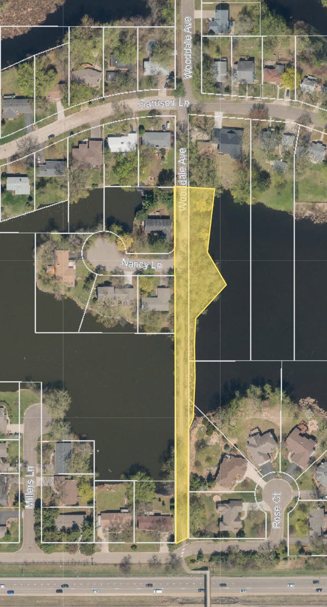
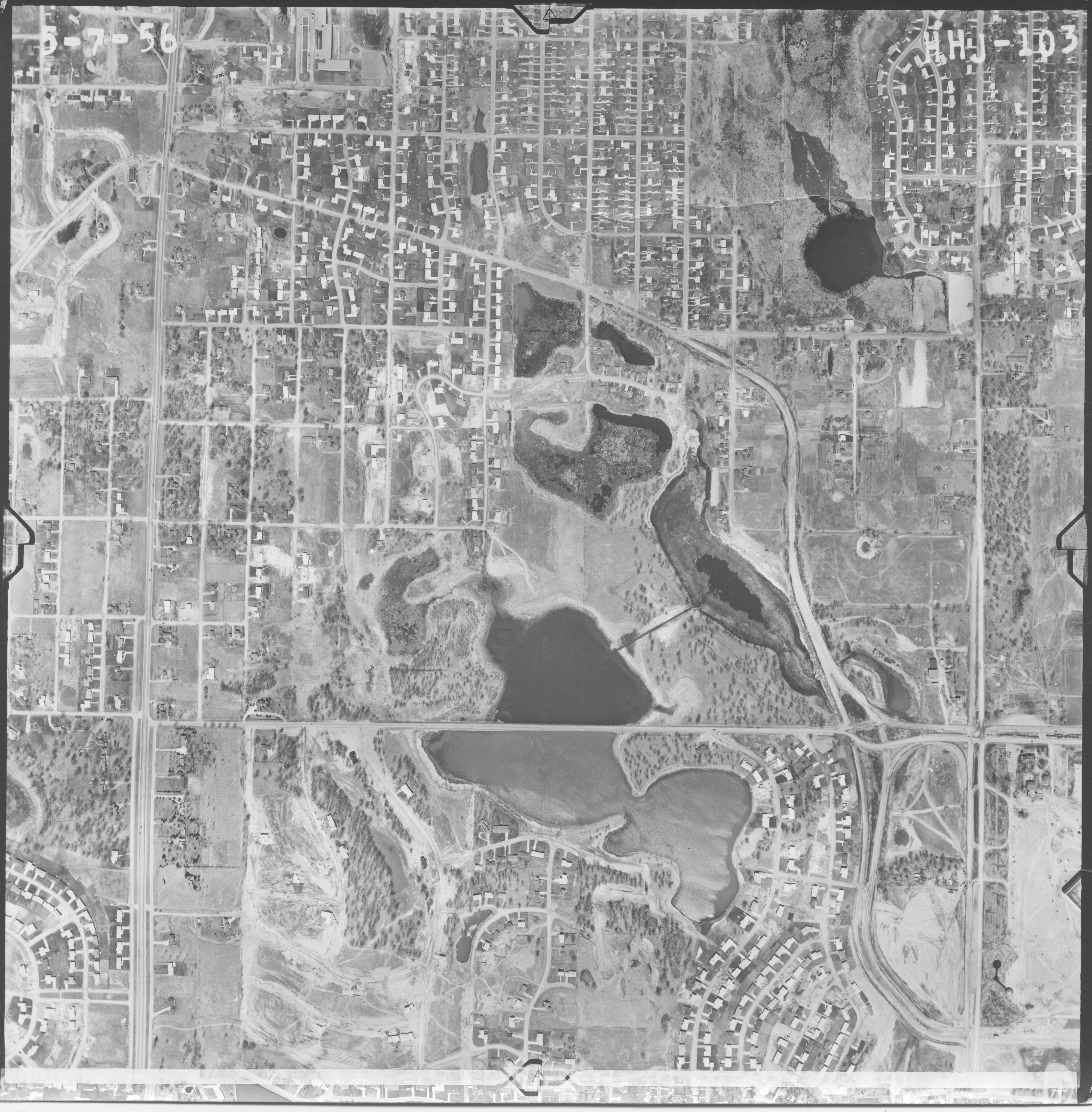
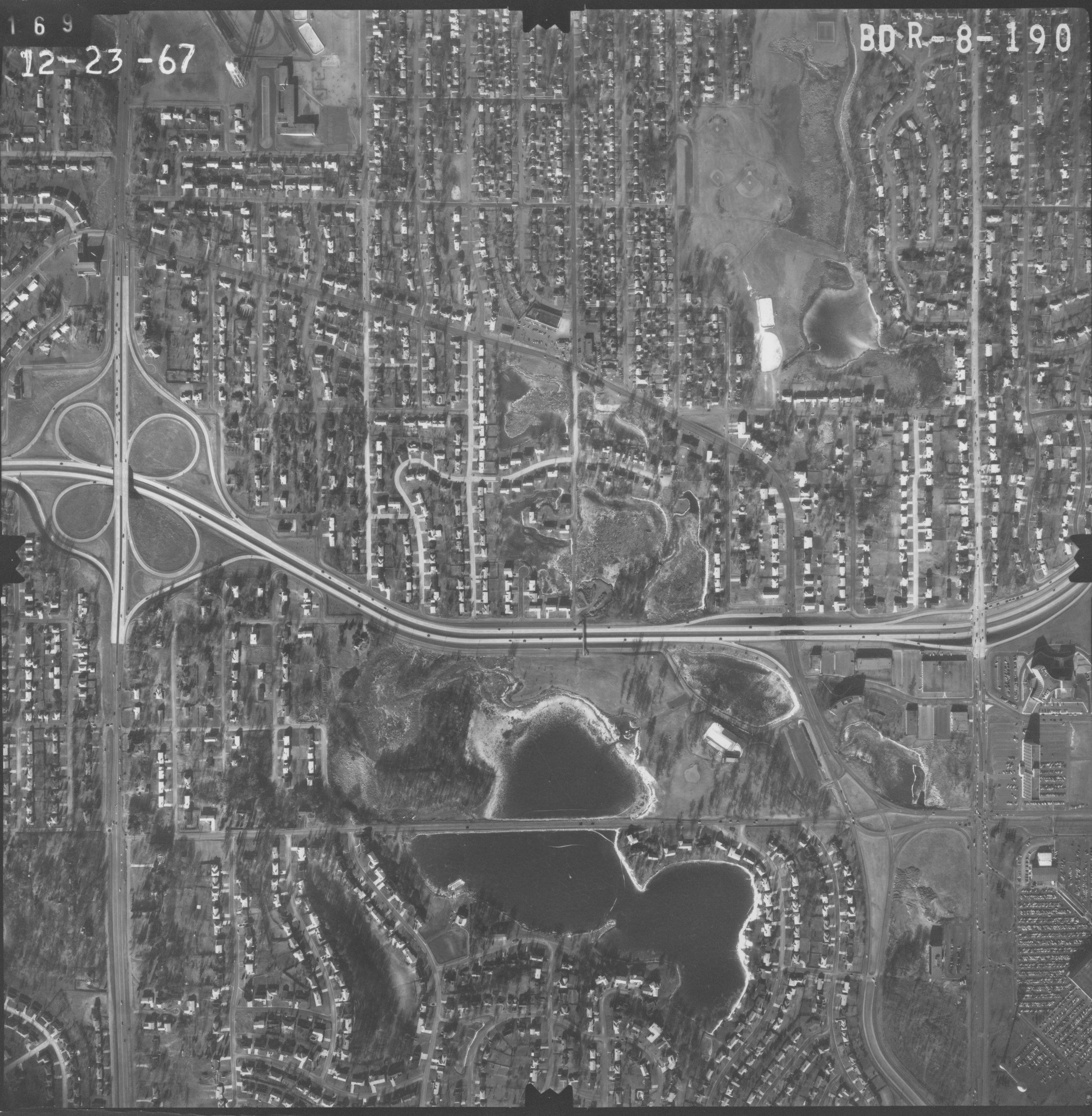
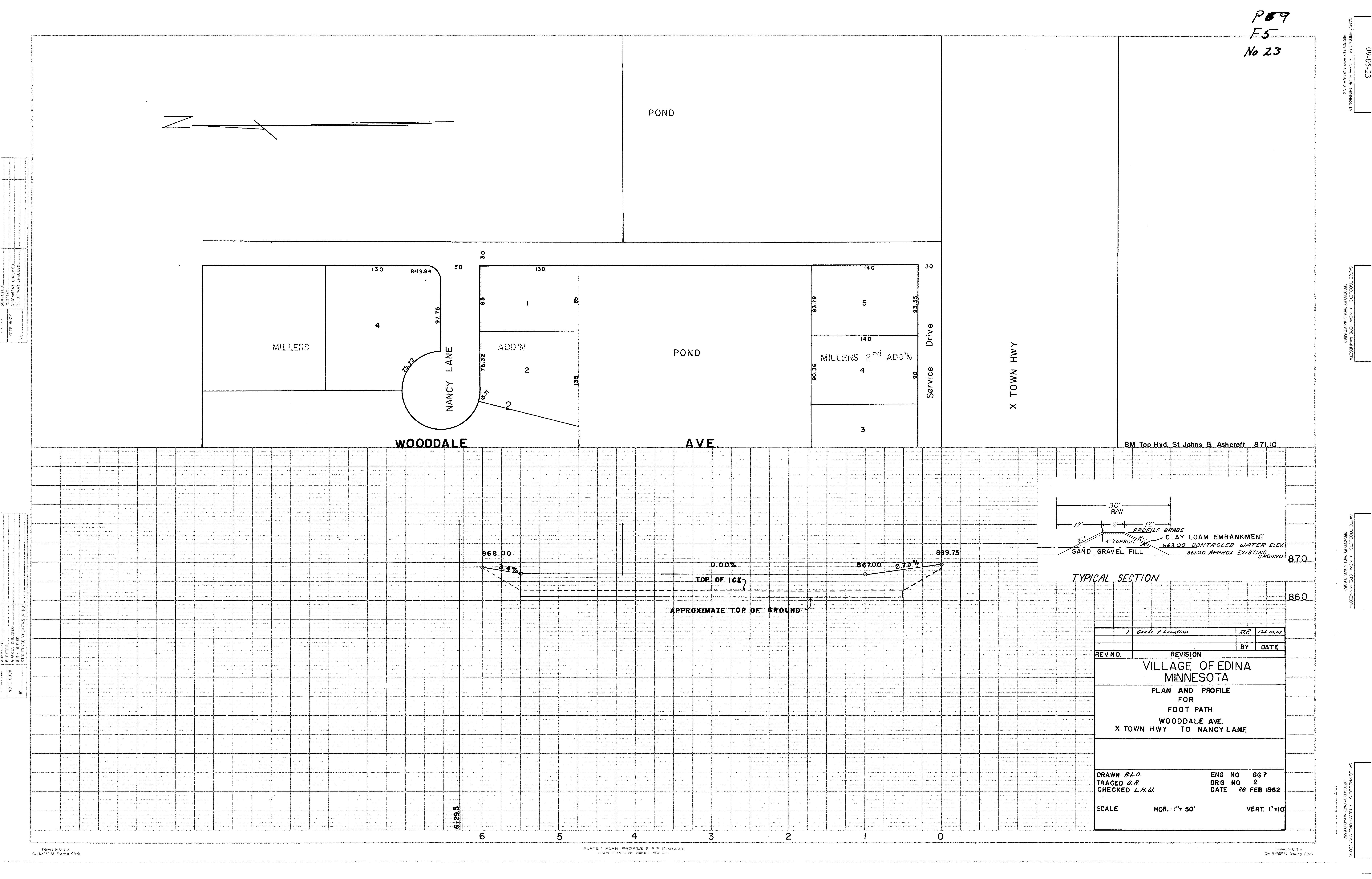
Local waterbodies were heavily altered in the late 1950s/1960s with the construction of crosstown Highway 62. The Wooddale walking path that bisects present day Lake Nancy and Otto Pond was constructed in 1962. Check out the historic aerial photos here.


Share Wooddale Path Meeting - June 8 on Facebook
Share Wooddale Path Meeting - June 8 on Linkedin
Email Wooddale Path Meeting - June 8 link
The Lake Nancy Lake Association hosted a discussion at the Wooddale Path yesterday with Engineering Director Chad Millner and Water Resources Manager Jessica Wilson. We talked about safety, the environment, protecting the shoreline, and the MnDOT bridge over Highway 62. It was a good opportunity to share the new Wooddale Path Landscape Restoration Project with the group.
In true Minnesota style, a lot of treats were provided and there were a lot of leftovers. Thanks for sharing with the Engineering Department!

Share Welcome on Facebook
Share Welcome on Linkedin
Email Welcome link
Welcome to the project page! This is where you can find project information and participate in the process. Please visit often to get the latest updates.
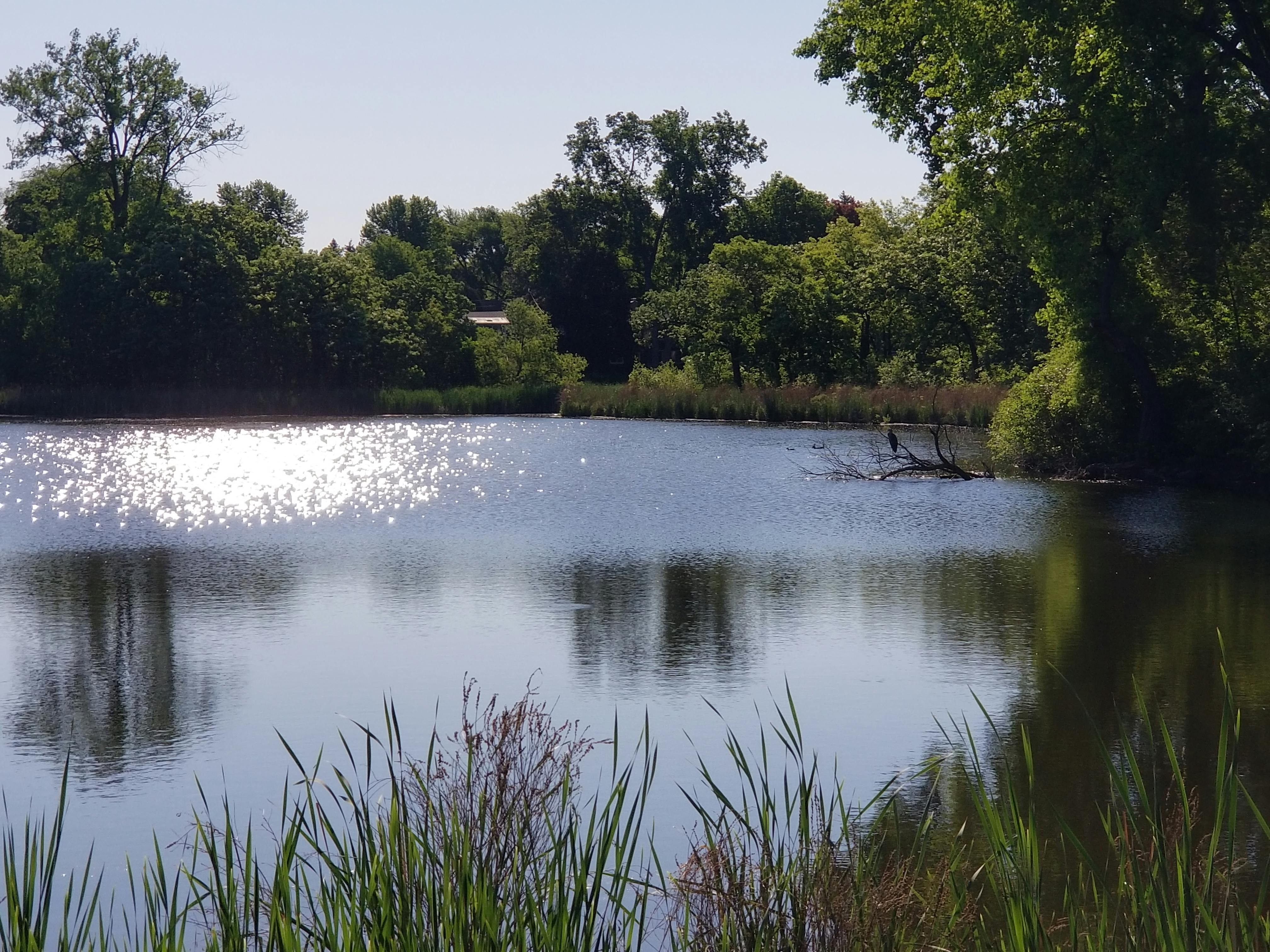
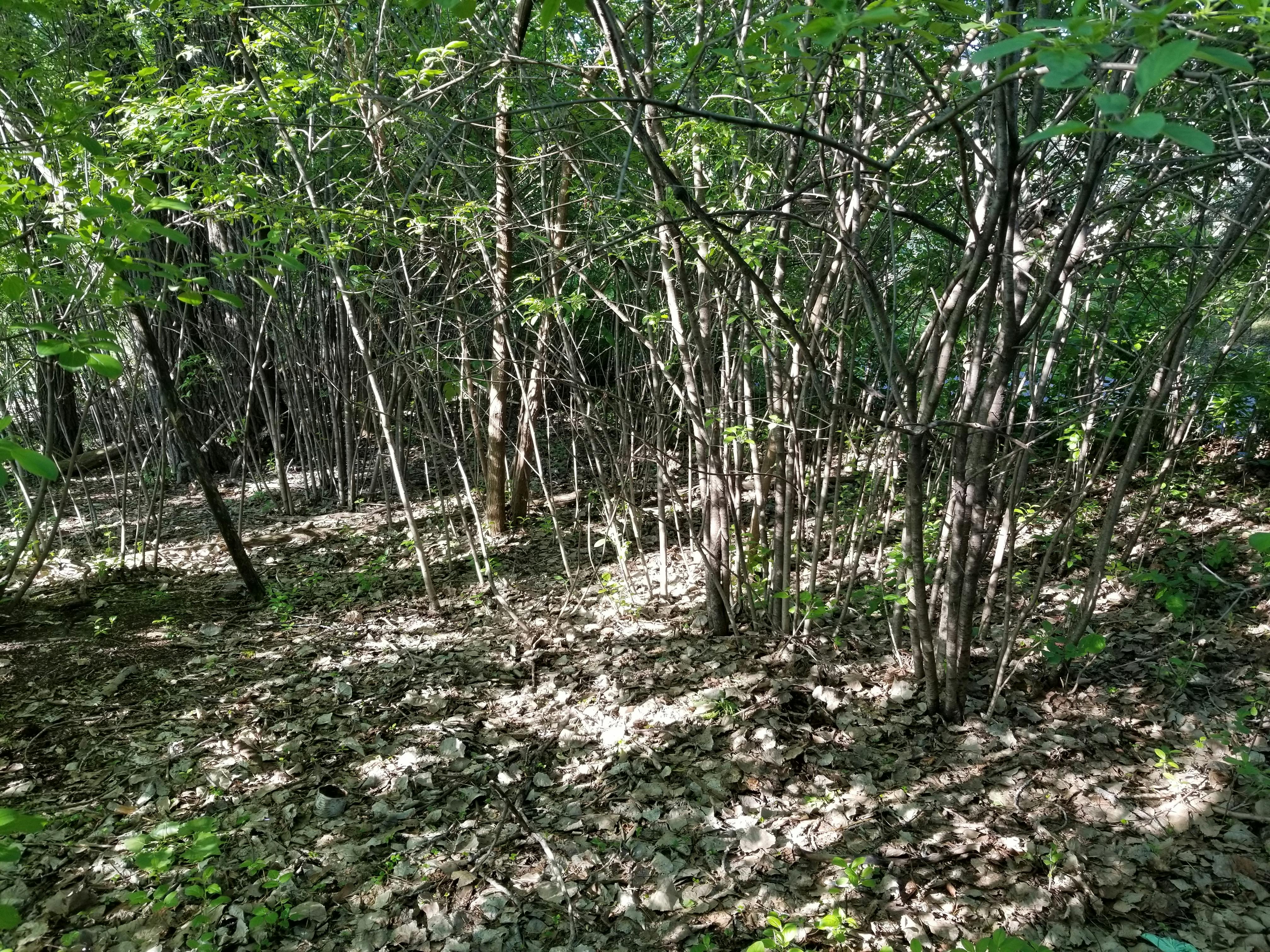
 A view of Otto Pond from the Wooddale Path, June 2022.